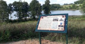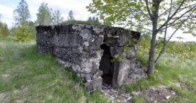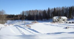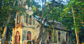
Fortification at Laukesas Lake of the 77th Reserve Infantry Division of the Imperial German Army
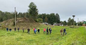
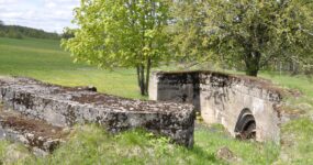
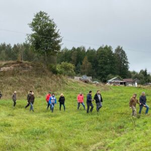
It was one of the strongest support points of the German Kaiser’s Army, where the units of the 77th Infantry Reserve Division were located. This division was headquartered at the former Laukesas Manor on Lakesas Lake. The Germans had dug an underground cave from the rectory of the village of Smeline to their forward positions. Balks from the destroyed Church of the Discovery of the Holy Cross in Smeline were used for the construction of the cave and bunkers. GPS: 55.744317, 26.304773

The cemetery of German soldiers of the First World War in the village of Bartkiske
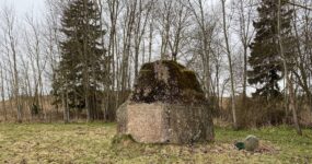
During the First World War, many soldiers of the German and Russian army died in the entire Zarasai District and Turmantas neighbourhood. A cemetery for fallen soldiers of the 88th Infantry Division of the German Imperial Army was established here, in the former village of Bartkiske. A surviving pink granite monument was dedicated to the division commander, Lieutenant General Wilhelm von Menges, and to the fallen soldiers of this division. The cemeteries were destroyed during the Soviet era. GPS: 55.690221, 26.450553
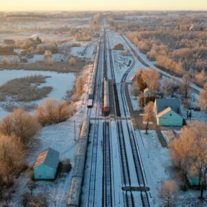
The railway network in the Zarasai Region during the First World War
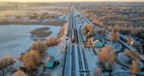
Turmantas Railway Station became an important object in 1916. As the German army established defensive lines at the front, it was very important to have an efficient logistics network. The old town of Turmantas built in the time of the tsar, the former dormitories of railway workers and the railway station can be seen. GPS: 55.699194, 26.465501
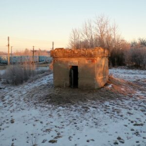
Long-term firing point by the railway
The construction of an active importance with four machine gun firing ports. The German inscription has survived. It is believed to be the remains of the “Memelburg” inscription. Some of the openings are bricked up. The structure is designed to protect the railway territory and warehouses from enemies or saboteurs. GPS: 55.695833, 26.463988

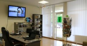
First World War exposition in Turmantas
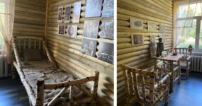
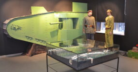
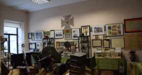
The First World War exposition in Turmantas is a part of the international cross-border route “Along the Footsteps of the First World War”. Unique artefacts, replicas, photographs from the First World War can be seen in the exposition. Information about the route is provided here, the virtual reality experience and guide services are offered. Tilžes iela 21, Turmanta, Zarasų rajons. GPS: 55.691923, 26.467024
Fortification building of the First World War – gunpowder and ammunition warehouse
On the southern edge of the town of Turmantas, on the way to the village of Tilze, there are two huge, hill-like buildings. These are World War I gunpowder and ammunition depots. Ammunition and other supplies brought by train were stored in a warehouse and distributed to the soldiers. GPS: 55.687587, 26.467224
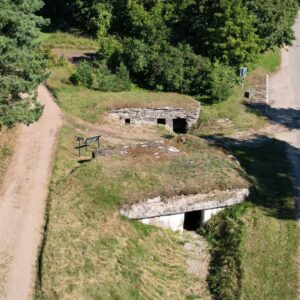
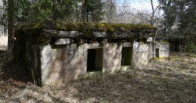
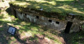
Blindages of German Army in the village of Tilze and forest
Blindage – a battlefield hiding place made to protect against heavy fire strikes. All hideouts were built according to a typical scheme, only the sizes of the fortification structures differed. There were two entrances on the sides of the facade wall, between which was a small row of windows. Many blindages located in the village of Tilze are included in the register of cultural heritage. Information boards are placed nearby. GPS: 55.660275,26.566061; 55.666925,26.563367; 55.66446, 26.56501; 55.66579, 26.56645; 55.66692, 26.56336; 55.65956, 26.55388
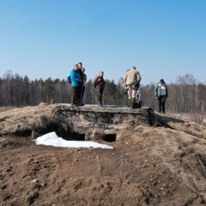
World War I artillery position tracking and cover bunker of the German Army in the village of Kimbartiske
An observation post covering the approach to the artillery positions. Despite its small dimensions, it is equipped with an opening for a periscope and three firing openings for machine guns. There was continuous telephone communication at the observation post by means of which the fire from the adjacent artillery batteries was regulated. GPS: 55.649135, 26.542932
Artillery positions of the German Army in the village of Kimbartiske
The positions at this location are fortified batteries that have survived along with a complex of auxiliary buildings. Such a battery had two covered fortifications (casemates) for weapons and safe rooms for soldiers and ammunition. Reinforced batteries made it possible to protect the weapons not only from enemy fire, but also made them invisible to aerial reconnaissance. GPS: 55.649012, 26.538124

Artillery battery of the German 77th Reserve Infantry Division near Biruliski
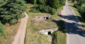
Artillery batteries were usually located behind the front line of defence. This site was located approximately 6 km from the front line and consisted of 4 pairs of bunkers located 30 meters apart. A gun position was located between the adjacent bunkers. The ammunition was placed in the rooms on both sides of the cannon and were stored separately for each gun group to prevent the possibility of detonation. GPS: 55.723279, 26.427541
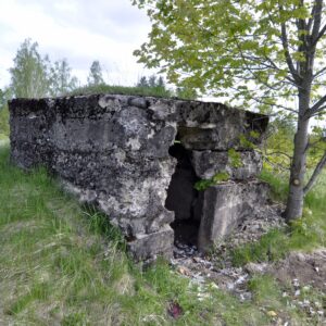
Observation and machine gun bunker of the German 77th Reserve Division
It was placed on the second line of defence, which was also called the inner line. It was set up as a backup in case the first one bunker broke through. Well-armed observation post, machine-gun nest, slightly out of line of trenches. An embrasure directed towards the enemy. GPS: 55.761024, 26.359518
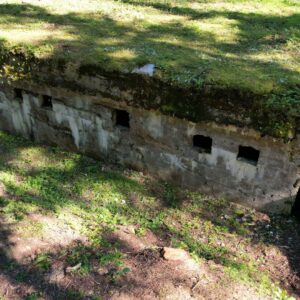
The cemetery of German soldiers of the First World War in the village of Sakiai and the location of the Landwehr Infantry Brigade
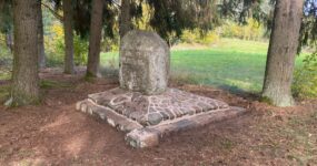
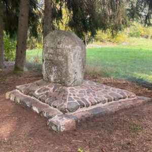
The place where the 175th Landwehr Infantry Brigade was stationed more than a hundred years ago. Together with several regiments, it formed a military town called “Berlin”, with its fortifications, a military hospital, residential buildings and a cemetery, which has survived to this day. There is a memorial stone with the inscription in German “For the fallen members of the 175th Landwehr Infantry Brigade”. GPS: 55.656500, 26.534080
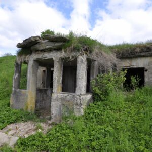
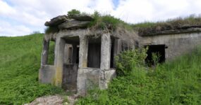
The bunker (headquarters) of the German 77th Reserve Division near the Egypt’s Church
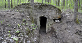
The bunker was located on the second defence line, 5-10 kilometres from the front line. This bunker was a place where officers lived and the headquarters of the 257th Reserve Infantry Regiment. In order to feel better in the landscape of war, the Germans spared no time in building underground towns that would at least somewhat resemble homes. Hideouts and other building complexes were built on the hill, the stove provided heat to this structure and reduced humidity. Two metal hooks (holders for insulators) can be seen next to the building’s porch, which means that the building was provided with electricity. GPS: 55.746247, 26.310622
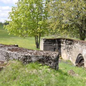
Artillery position bunker of the German 77th Reserve Division
Artillery positions were located on the hill, near the buildings of the homestead. It was made of three concrete structures and rooms for ammunition. Howitzers or field and fortress guns could stand in such fortified points. The size of the embrasure was larger for howitzers. Colonel Racenstein, a resident of Smeline, was the chief of the 77th Reserve Artillery Division. He commanded two reserve artillery regiments, each regiment had six artillery batteries of four guns, a total of 48 field guns and 12 heavy field howitzers. GPS: 55.723004, 26.442838
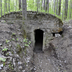
The hiding place of the German 77th Reserve Division – a bunker for soldiers to rest
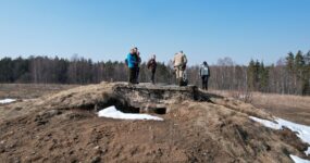
The hideout, which was behind a hill, in a forest ditch, in the immediate vicinity of the first defence line, where soldiers could warm up, dry off, eat or take a nap. There were not only trenches and trenches for shooters in the first defensive positions, but also auxiliary buildings that provided temporary rest, shelter from bad weather and the hideout from explosions of shrapnel and shrapnel shells. There were sheds for telephone operators, dressing rooms, command posts and observation posts for officers. The dugouts had electric lighting, sleeping places, a floor covering, and plastered walls. Telephone lines ran from underground command posts to artillery batteries. GPS: 55.766045, 26.355847

Exhibition of the First World War in Medumi
The “Life and Death” front line was set on the territory of Medumi for several years during the First World War. A complex system of fortifications with ditches, trenches and bunkers was built on both sides of it. Museum in Medumi is a great place to look at the historical artifacts found in the surrounding forests. Besides, visitors сan imagine themselves in the role of a soldier by entering the bunker or passing through the trenches that are created in the museum premises. Alejas iela 20, Medumi, Medumu pagasts, Augšdaugavas novads, GPS: 55.783730, 26.351379
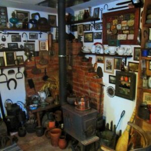
The private collection of the First World War heritage and local history
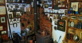
The private collection is placed in a small building specially built for the museum and its visitors can look at historical evidence of Medumi and the surrounding area. The family of Stikani is engaged in collecting historical artefacts of the World War I and World War II. Jaunatnes iela 4, Medumi, Augšdaugavas novads, +371 25960552, GPS: 55.784962, 26.361653
Accommodation
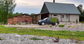
Cottage “Forest Lake”
Teteri, Kamariški, Medumu pag., Augšdaugavas nov.,
+371 29488669, +371 27555383,
GPS: 55.748423, 26.361843
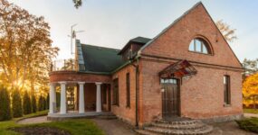
Recreation Complex “Saulesstari”
Alejas iela 44, Medumi, Medumu pag., Augšdaugavas nov.,
+371 22052626,
GPS: 55.7897233, 26.349413
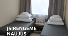
Guest House “Zarasai”
Dariaus ir Girėno g. 11/15, Zarasai,
+370 618 04674,
GPS: 55.732346, 26.251141
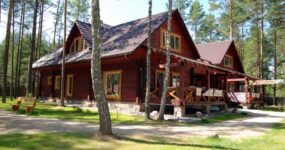
Guest House – Café “Smalvos“
Gailiutiškės k., Turmanto sen., Zarasų r.
+370 678 02221,
GPS: 55.610014, 26.384651
Catering, shops
Cottage “Forest Lake”
Teteri, Kamariški, Medumu pag., Augšdaugavas nov.,
+371 29488669, +371 27555383,
GPS: 55.748423, 26.361843
Recreation Complex “Saulesstari”
Alejas iela 44, Medumi, Medumu pag., Augšdaugavas nov.,
+371 22052626,
GPS: 55.7897233, 26.349413
Guest House “Zarasai”
Dariaus ir Girėno g. 11/15, Zarasai,
+370 618 04674,
GPS: 55.732346, 26.251141
Guest House – Café “Smalvos“
Gailiutiškės k., Turmanto sen., Zarasų r.
+370 678 02221,
GPS: 55.610014, 26.384651
Museums, cultural objects
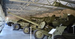
The Museum of Military Vehicles
Alejas iela 7, Svente, Sventes pagasts, Augšdaugavas novads,
+371 65427822,
GPS: 55.903389, 26.376277
Museum of the World War I “Pie Komendanta”
Komandanta iela 1, Daugavpils,
+371 29244651, +371 26888122
GPS: 55.885073, 26.496859
Museum of Zarasai Region
D. Bukonto g. 20, Zarasai,
+370 385 52290,
GPS: 55.728384, 26.245217
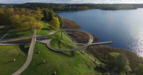
Zarasas Lake Observation Bridge
Kauno g. 67, Zarasai,
+370 682 40988,
GPS: 55.719104, 26.221062
Zarasai Public Library
D. Bukonto g. 20, Zarasai,
+370 385 52279,
GPS: 55.728456, 26.245330
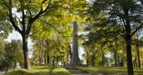
Obelisk to commemorate Saint Petersburg – Warsaw tract
Vytauto g. 15, Zarasai,
GPS: 55.732713, 26.252972
Leisure activities
Ski Resort “Egļukalns”
“Egļukalns”, Kalnāji, Sventes pagasts, Augšdaugavas novads
+371 22034430, +371 20382060,
GPS: 55.8731867, 26.3299732
Ski Resort “Egļukalns”
“Egļukalns”, Kalnāji, Sventes pagasts, Augšdaugavas novads
+371 22034430, +371 20382060,
GPS: 55.8731867, 26.3299732
Sacral heritage
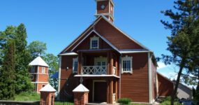
Smalvos Our Lady of the Rosary Church
Dvaro g. 2, Smalvos, Zarasų r.
GPS: 55.641324, 26.361162
Turmantas Sacred Heart of Jesus Church
Žalioji g. 3, Turmantas,
GPS: 55.695582, 26.458297
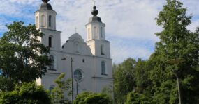
Church of the Assumption of the Blessed Virgin Mary
Bažnyčios g. 3, Zarasai.
GPS: 55.730608, 26.245625
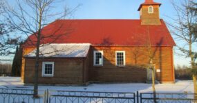
Egypt’s Lutheran Parish Church
Ēģipte, Medumu pagasts, Augšdaugavas novads
GPS: 55.747604, 26.311627
Tourist Information Centres
Zarasai District Tourism and Business Information Centre
Sėlių a. 22, Zarasai,
+370 682 40988,
GPS: 55.732474, 26.246642
Daugavpils Tourist Information Centre
Rīgas iela 22a, Daugavpils,
+371 65422818, +371 26444810,
GPS: 55.870838, 26.517395
Zarasai District Tourism and Business Information Centre
Sėlių a. 22, Zarasai,
+370 682 40988,
GPS: 55.732474, 26.246642
Daugavpils Tourist Information Centre
Rīgas iela 22a, Daugavpils,
+371 65422818, +371 26444810,
GPS: 55.870838, 26.517395
